BP Angola Block 31 Year Two AUV Survey Project
- 2008-10-23
- By admin
- Posted in Route survey
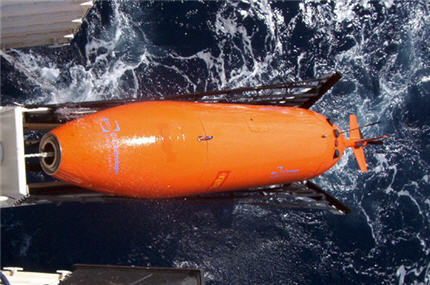
Sub-contracted through NetSurvey to provide BP Exploration (Angola) with a Client Representative onboard the RV Northern Resolution, responsible for multibeam data quality control. The Block 31 Year Two AUV survey project is designed to cover several prospective oil fields that will be exploited by one or more development projects. Results from the geophysical site investigation survey are needed for the assessment of geohazards for drilling development wells, and in support of facilities engineering design. An area of approximately 684 square kilometres was surveyed, with water depths ranging from 1545m to 2600m. The survey was conducted using C&C Technologies AUV C-Surveyor II, equipped with a Kongsberg EM2000 multibeam system, Edgetech sidescan sonar and Chirp sub-bottom profiler. The Caris HIPS and Fledermaus software packages were used for data verification and visualization.
Recent Posts
- BP Northern Endurance Partnership Route & Area Survey 20/04/2021
- BP Caspian Shallow Water Pipeline Inspection Survey 13/01/2020
- Equinor Nearshore Pipeline Inspection Survey Project 23/10/2019
- SSEN Pentland Firth HVAC Survey Project 14/09/2019
- Equinor Norpipe Nearshore Pipeline Inspection Survey Project 02/09/2019
Recent Comments
- admin on Marin Mätteknik Culver Sands to Flat Holm Survey
- martin sharp on Marin Mätteknik Culver Sands to Flat Holm Survey
- admin on Marin Mätteknik Culver Sands to Flat Holm Survey
- Arien Kampman on Marin Mätteknik Culver Sands to Flat Holm Survey
- Fred Colebrooke on Marin Mätteknik Lyme Bay – Natural England Survey
Archives
Categories
- Archaeology (3)
- Hydrographic survey (36)
- Other (13)
- Pipeline construction (11)
- Pipeline inspection (14)
- Renewables (8)
- Route survey (10)
- Topographic survey (1)
- UXO survey (6)